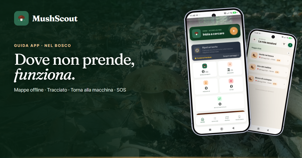
An app for mushroom growers works in the worst place there is for a phone: under the trees, in a valley, with a notch that comes and goes and the battery runs out quickly. If it only works with the field, it doesn't work.
The one that works without signal
- Saving a find: never blocked, neither offline nor beyond the free plan thresholds. It synchronizes itself when the signal returns.
- The GPS track: records the route, with distance and difference in altitude, even with the screen turned off and the app closed.
- Back to the car: arrow and distance to find the parking spot, even at zero marks.
- The diary and maps already seen: they remain consultable, together with your seats and cards.
- The position even without hooking: you mark the mushroom as soon as you see it and the point remains the same, the app fixes it when the GPS locks.
GPS, it should be remembered, is not the telephone network: the telephone receives satellites even where there is no reception. What's missing offline isn't the location, it's the maps to download — and that's the problem that the app solves on its own.
The app keeps the map for you
When you leave for an outing, the app keeps the forest around you: the area you looked at while you had camp remains available even where there is no camp. You don't have to remember anything, and it's designed specifically for the trip decided at the last moment.
However, it is still a good habit to download the area first, if you already know where you are going: it takes a minute and also covers the wide turns. One zone in the free plan (up to three watching a video), unlimited with Premium. The available maps are satellite, topographic and trails.
The track doesn't lie
Under the ferns the signal is lost: this happens to all devices, even the good ones. The difference is what the app does at that moment.
Many draw a straight line between the last valid point and the first good one, and give you a clean path which however goes straight through a channel where you have never been. Here the route yes break, and at the end of the exit the app tells you if you were walking in that hole and how many meters it didn't record.
An inflated mileage is useless. Knowing that in the hole you were climbing, and how much, yes: that's what makes it useful to look back on the ride a year later.
Go back to the car
In the woods you get lost for a banal reason: you look at the ground. You enter from a path, follow a row of chestnut trees, go around a stump and after an hour the slope seems different.
The function does only one thing and it does it offline: an arrow towards the point where you left the car and the distance as the crow flies. It's not road navigation - it wouldn't be useful in the woods - it's the orientation you need to decide which way to go back up.
The SOS button
In distress, a button displays your exact coordinates, sends a text message to your chosen emergency contact, sounds an audible alarm and turns on the flashlight.
Three things to know:
- And free for everyone, forever, and it works even without an account: security is not a function to be sold;
- the SMS also starts with a very weak signal, where a phone call would not get through;
- readable coordinates are what rescuers ask for first, and it's the main reason this button exists.
That said: it does not replace a call to 112, and the emergency contact must be set Before, at home, not when needed. Before going out, telling someone where you are going and what time you expect to be back remains the precaution that works better than any app.
The battery
The track uses GPS, and GPS consumes: it's physics, not software. Two tricks that are worth more than any setting — keeping the screen off while walking (the recording continues anyway) and carrying a small external battery on long outings. In the cold the charge drops faster, so in the fall the phone fits better in an inside pocket.
Frequently asked questions
Does the track work with the screen off?
Yes, continue recording with the screen off and the app closed.
Can I use maps without field?
Yes. When you leave, the app takes care of the forest around you; if you download the area first, it works offline even on the largest laps, together with the diary and the track.
Does GPS work without a telephone network?
Yes: the position comes from satellites, not from the network. Without the field, all that's missing is the map to download, and that's what keeping it offline is for.
Is SOS paid?
No. It's free for everyone, forever, and it works even without an account.
Why does my track have holes?
Because the signal was lost there, and the app prefers to show it instead of inventing a straight line. At the end of the exit it tells you how many meters to go and whether you were walking in that stretch.